on the island of Hawaii
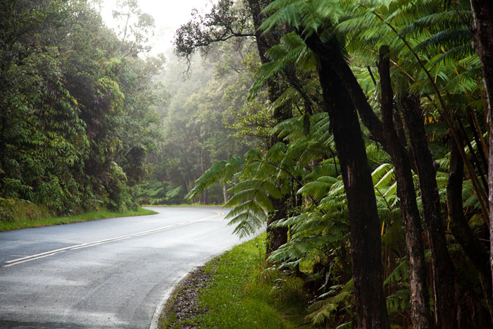
Visitors with a driving urge to see the island of Hawaii by car find a lei of adventures and scenic diversity circling the island—from the black lava plains of Kona and the Kohala Coast to lush greens of the Hamakua Coast. Almost every mile has its own special appeal, and road tripping along our designated Scenic Byways and Heritage Corridors takes voyagers through wildly contrasting landscapes, and from the present into the past, along historic routes and quiet backroads where every turn brings a surprising glimpse of authentic Hawaii.
The "Royal Footsteps Along the Kona Coast” drive begins just 8.2 miles from Ellison Onizuka Kona International Airport in an area once known as Kamakahonu (the eye of the turtle). Here, Alii Drive starts at Courtyard by Marriott King Kamehameha’s Kona Beach Hotel, a Kailua-Kona landmark that houses an important historical and cultural site.
After uniting the Hawaiian Kingdom, King Kamehameha I kept his royal residence here at Kamakahonu from 1812 until his death in 1819, and during this time he re-built the ancient Ahuena Heiau, a temple dedicated to the god Lono. The thatched-roof structure was restored in the 1970's, and is maintained on the property, protected as a National Historic Landmark.
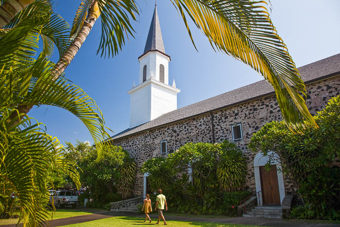
Just south and across Alii Drive is Mokuaikaua Church, founded by the first Christian missionaries to arrive in Hawaii in 1820 aboard the Brig Thaddeus. From its origins as a thatched hale (structure), this beautiful old stone edifice was built by missionaries in 1837 as is the first commissioned Christian church in Hawaii. Constructed of lava rock and crushed-coral mortar, its interiors are fashioned from native ohia and koa woods. It is open to the public and Sunday services welcome visitors at 9 and 11 a.m. www.mokuaikaua.com
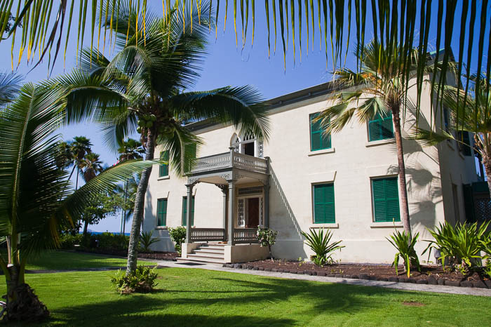
Mokuaikaua marks the beginning of the missionary era. In 1838, one year after the church was completed, Hulihee Palace was built nearby on Alii Drive. A summer home for Hawaiian royalty, Hulihee Palace is a dramatic symbol of the drastic change that occurred in less than 50 years. Governor John Adams Kuakini, brother of Queen Kaahumanu, favored wife of King Kamehameha I, used the home as a vacation residence until the overthrow of the monarchy in 1893.
In 1925, Hulihee Palace was purchased by the Daughters of Hawaii, a cultural preservation and civic society, to prevent it from being auctioned. It remains today, as one of only three royal residences in the United States. Docents maintain stewardship of the building and its manicured grounds, museum and gift shop. The palace boasts fascinating Hawaiian antiques, including a formal dining table carved from a single tree, a steamer trunk used by Queen Kapiolani on her 1887 voyage to England, priceless pre-contact artifacts, tools and jewelry and handmade Hawaiian quilts. Open Tuesday-Saturday, 10 a.m.-3 p.m. Admission fee. www.huliheepalace.net
Close to these historic sites is a different kind of structure with a history of its own. Kailua Pier, built in the early 1900s, was once the center of transportation and shipping for West Hawaii, where paniolo (Hawaiian cowboys) swam their cattle out to ships, and coffee farmers carried their cargo. Today, the pier is the focal point of the annual Hawaiian International Billfish Tournament, where hundreds of crews have competed for "granders,” trophy fish of 1,000 pounds or more, since 1959. It’s also the start and finish line of the IRONMAN World Championship held every October.
Traveling south along the seven miles of the Royal Footsteps, adventurers cruise along the ocean, through a clutter of colorful shops and restaurants, filled with strolling visitors from near and far.
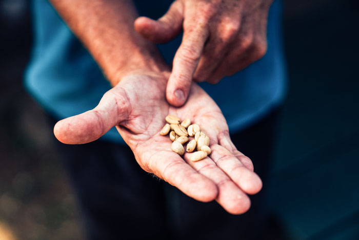
Stepping outside the "Footsteps” themselves, story-seekers continue south through Kainaliu town, and into Kealakekua. Here, the Kona Historical Society’s H.N. Greenwell Store Museum, a restored mercantile shop from 1870, and the Kona Coffee Living History Farm share history through the eyes of Kona families and farmers, "coffee pioneers,” from 1926-1945.
The country’s only living history coffee farm allows visitors to interact with costumed historians, meet a "Kona nightingale” (pack donkey) and take a walk back into a different time. Homesteaded in 1900 by a Japanese immigrant family, the farm is listed on both the State and National Registers for Historic Places. The farm is open Monday-Friday, 10 a.m.-2 p.m., offering "Hands on History” and other special programs throughout the year, including weekly Portuguese sweet bread baking demonstrations in the wood-fired forno oven. H.N. Greenwell Store is open Monday, Tuesday, Thursday and the first Saturday of every month, 10 a.m.-2 p.m. www.konahistorical.org
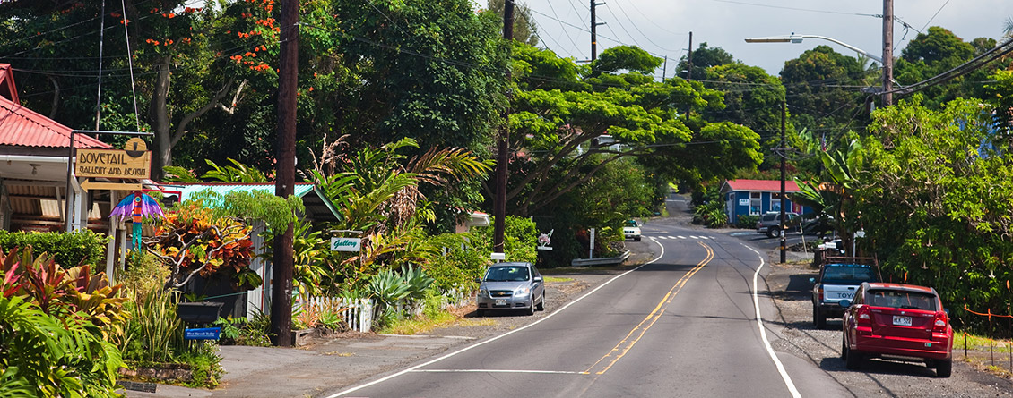
Up ma uka (towards the mountain), to the 1,400-1,500-foot level, the Mamalahoa Kona Heritage Corridor meanders along the slopes of Hualalai. A scenic, two-lane country road, this byway travels ten miles along Route 180, between Palani Junction and the intersection of Route 11/Kuakini Highway, passing through the vintage village of Holualoa, located in the heart of Kona Coffee country. A stroll through town shares its history, with numerous signs and stories, from Kimura Lauhala Shop, est. 1914, to the old Kona Bottling Works, and the 1897 Holulaloa School. Many of these historic buildings are home presently to art galleries and studios. For more information, visit www.holualoahawaii.com
It’s interesting to know that this byway’s name, Mamalahoa, is actually a modification of the road’s original name, Mamalahoe Highway. Once known as a well-used trail by ancient Hawaiians, the route encircling the island was named Mamalahoe (mamala, splinter, and hoe, paddle) referring to the "law of the splintered paddle.” One of the first laws enacted by King Kamehameha I, this law came to be when the king himself was struck with a canoe paddle—which splintered—by a man attempting to protect his home from who he assumed was a common intruder. Instead of punishing the man, Kamehameha declared that all travelers on the roads and trails of his kingdom were not to be harmed.
Another part of Route 11 winds into the 54-mile Kau Scenic Byway, "The Slopes of Maunaloa.” This picturesque road travels from Historic Kailua Village to Hawaii Volcanoes National Park, by way of the southernmost point of the U.S. at Kalae, unique black sand beaches at Punaluu and sweeping views of ocean, mountain and the unspoiled "moonscape” of relatively recent lava fields. The Kau Scenic Byway is sponsored by the Kau Chamber of Commerce.
The route passes numerous coffee farms, where, in season, fragrant sprays of white flowers are so numerous it’s known as "Kona snow.” Continuing south, the scenery changes from lush, green and jungly to drier and darker; the road gets emptier, with longer stretches in between buildings and the air may be misty and damp. At Manuka State Wayside, visitors find an eight-acre arboretum, originally planted in the mid 1800s, which now contains 48 species of native Hawaiian plants and more. The byway passes through Naalehu, the southernmost town in the U.S., and Punaluu, where the renowned Punaluu Sweetbread Factory bakes thousands of loaves of this tasty local favorite every week, along with cookies, anpans, malasadas and more. www.bakeshophawaii.com
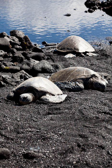
Nearby, Punaluu Beach Park is one of Hawaii’s most dazzling black sand beaches, frequently a resting place for sunbathing honu (sea turtles).
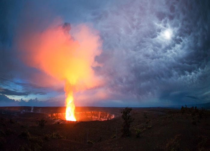
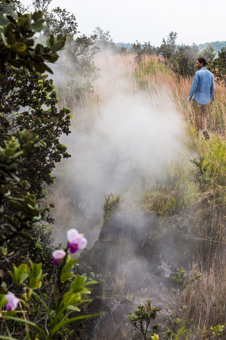
The Kau Scenic Byway arrives at Hawaii Volcanoes National Park, a place where each road and trail is breathtaking in its own way: forests filled with endemic birds, twisted ohia trees, bejeweled by the Island’s official red flower, ohia lehua, whisping steam vents, a walk-through lava tube and more. From Crater Rim Drive, the Chain of Craters Road drops down a titanic slump to the coast—3,700 feet in 20 miles—which collapsed in an earthquake centuries before. Chain of Craters Road is subject to closure due to eruption conditions, and visitors should first check with the Visitor Center for information on this route, and other safety issues. www.nps.gov/havo
Once a vast stretch of thriving sugar cane fields, Hamakua Heritage Corridor travels from Hilo to the end of the road at the breathtaking Waipio Valley lookout. This is a head-turning tour with the ocean on one side and waterfalls, rolling hills and carved valleys on the other. Marked by farms, old plantation towns, historic points and spectacular lookouts, this drive takes road-tripping to the next level.
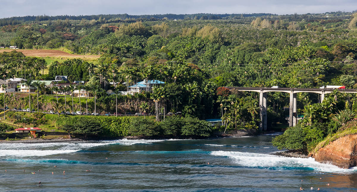
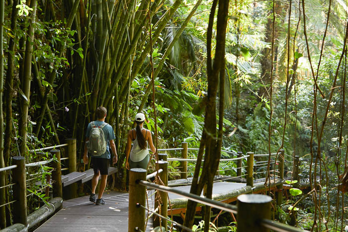
Just north of Downtown Hilo, a turn off Hawaii Belt Road/Highway 19, takes a beautiful detour along the four-mile Onomea Scenic Drive, with coastal views of the popular surf spot at Onomea Bay and the spectacular Hawaii Tropical Botanical Garden, a 40-acre "natural greenhouse” featuring 2,000 species of trees, flowers and plants plants from around the world. www.hawaiigarden.com
Nearby, in the small, former sugar cane town of Papaikou, explorers find the Hawaii Sugar Cane Museum, packed with history of an era gone by. In addition to farm and factory equipment, there’s military memorabilia, baseball uniforms, old tin signs, a gas pump, full size buggy and a complete restaurant booth from a popular steak house of the day. On a daily basis, those with ties to the sugar cane culture, drop in to the museum to talk story and share their memories. hawaiiplantationmuseum.org
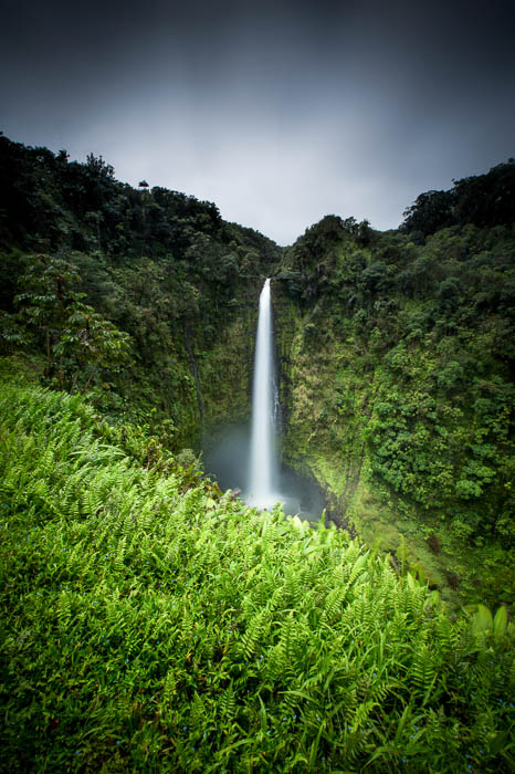
Continuing, adventurers discover the spectacular Akaka Falls State Park, a very special place, well-remembered in song and story. The half-mile loop trail to see the falls takes hikers through a veritable "Garden of Eden," with lush tropical rainforest of hapuu ferns, red and white ginger, banana trees, birds of paradise, plumeria, giant philodendrons and bamboo. The beautiful 442-foot Akaka Falls plummets down a sheer cliffside in veiled mists to Kolekole Stream below.
Just north of Akaka Falls is the World Botanical Gardens, with over 5,000 species of Hawaiian and tropical flora, a magnificent view of the three-tiered waterfall at Umauma and the 100-foot cascade of Kamaee Falls. Intrepid siteseers can experience the gardens by zipline or Segway as well. botanicalworld.com
The corridor continues along an old railway route, through three hairpin turns in steep gulches between high misty valley walls and the tumbling ocean coast. At Laupahoehoe Point, a beautiful ocean lookout, a marker pays tribute to those lost in the 1946 tsunami. Nearby is the Laupahoehoe Train Museum, with vintage photos, artifacts and documents from Hawaii Consolidated Railway that hauled sugar cane and other goods and passengers up and down the Hamakua Coast in the 19th and early 20th century. www.thetrainmuseum.com
At Kalopa State Recreation Area, peaceful hiking trails wander through a 100-acre block of native Hawaiian rainforest that is kept preserved in its natural state as much as possible. There are several enjoyable hiking trails, including the Kalopa Native Forest Nature Trail, an easy .7-mile loop. The forest here also has large tree ferns, kolea, kopiko, olomea, pilo, ground ferns and much more.
The corridor continues to Historic Honokaa Town, where Highway 19 curves inland and heads west. Honokaa, once a bustling sugar cane society center, has reinvented itself since the "final harvest” of 1994. Now it’s a colorful and creative community, filled with art studios and restaurants, local-made gift shops, and a treasure trove of thrift and antique stores—all proudly displaying their original building names, along with present businesses. Weekly farmers markets are more than food stands, with music and end entertainment, neighborly interaction, and aloha.
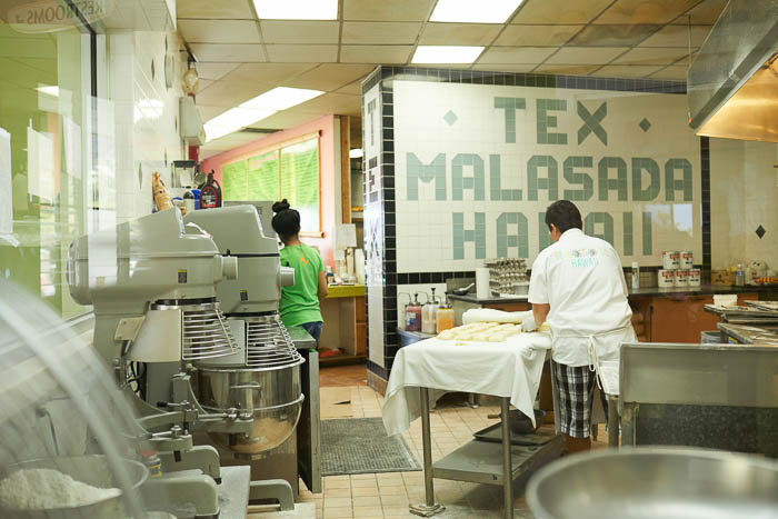
The local landmark, Tex Drive In, is easy to find as you approach Honokaa town, and it’s still the home of mouthwatering malasadas (Portuguese doughnuts), made daily in a dozen flavors to indulge in the moment, or box up to take home. www.texdriveinhawaii.com
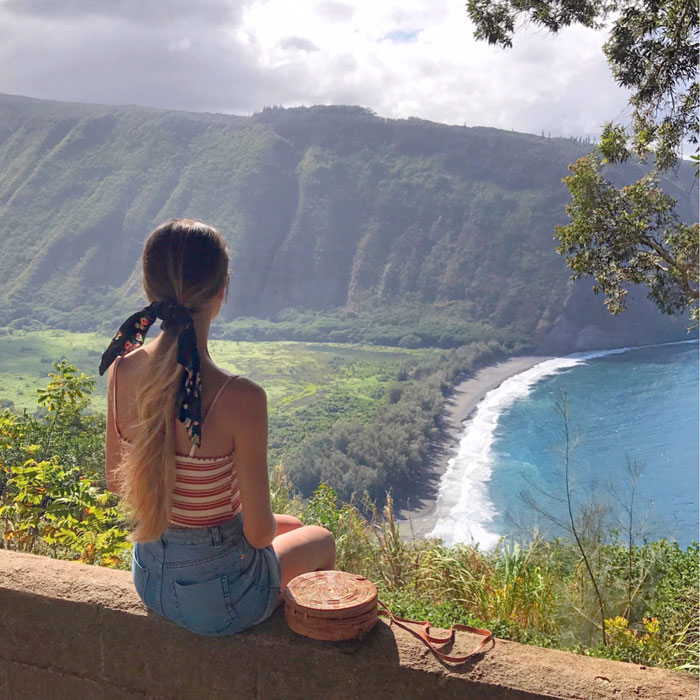
From Honokaa the short trip to the Waipio Valley Overlook is a must. The road ends at a breathtaking view of steep valley walls. Below, surf rolls into a placid, unspoiled gray sand beach; kalo (taro) farms and homesteads reach back into the green groves of trees where the river runs, and time seems to stand still. The twin waterfalls of Hiilawe grace the far back of the valley, telling their love stories, generations old.
Called the "Valley of Kings,” Waipio is an important wahi pana (sacred place) to Hawaiians. Rich in resources of fresh water and soil for food production, safe and protected, Waipio is where the child Kamehameha was taken into hidden care, far from the rival chief who wanted to preclude him from becoming king. The valley is best experienced by taking the Waipio Valley Shuttle, www.waipiovalleyshuttle.com; from above via ATV, www.ridetherim.com; or horseback ride, www.naalapastables.com/waipio.html.
Every mile of highway has a story to tell. Every turnoff and detour, back lane and town street can be a part of the island of Hawaii road trip experience. With eyes wide open and hearts set on adventure, the wise road-tripper knows it’s not about the destination, it’s about the journey.