Welcome to the
“It is a dimension as vast as space and as timeless as infinity. It is the middle ground between light and shadow, between science and superstition, and it lies between the pit of man's fears and the summit of his knowledge. This is the dimension of imagination.”
- Rod Serling
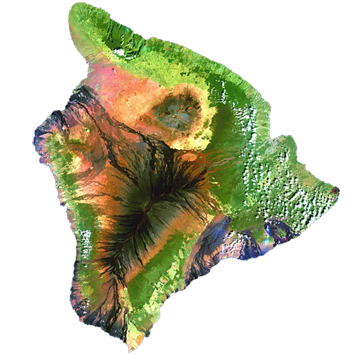
From space, the island of Hawaii captures the imagination like a work of abstract art. Her emerald eastern coasts, studded with rich rainclouds, reach up ma uka (inland, upland, towards the mountain) as far as they can, morphing at higher elevation to bare amber and crimson lands encircling the summit of Maunakea, sometimes capped in white. Her south and western flanks speak of motion, streaked with inky brushstrokes of lava flows that travel down the long ridges of Maunaloa to the sunbaked seacoast.
This is a place filled with stories and legends, inspired by our unique island environment. An environment so diverse in elevation, winds and rains, that it brings together a climatic microcosm of earth itself. These are the Climate Zones.
Dramatic intro aside, it’s still a SciFi-esque scenario, to think that one tiny place on the planet, only 4,028 square miles in all, could contain nearly all of the world’s potential climates. The idea has become a soundbite across the visitor industry, frequently quoted, often misunderstood, and ultimately cool. The science behind it is just as cool as the concept.
It began with the work of a German-Russian botanist and climatologist, Wladimir Koppen in 1884. Koppen was trying to show the relationship between climatic zones and vegetation zones, biomes, that were being mapped for the first time. He eventually categorized climate into five major groups and fourteen subgroups. These are based on temperature and precipitation, and range from warm, wet tropical to very cold polar.
Koppen modified the study several times, including collaborative work with Rudolph Geiger, and in 1928 they introduced a wall map to illustrate the system. Koppen continued to tweak the work until his death in 1940, and it’s since been modified by other climatologists. (Later systems added a sixth group, “Highlands,” which might include any of the others, at different elevations.)
In 1978, the Mauna Loa Observatory published a book as part of its 20th anniversary commemoration. It included the study “Climate and Water Balance on the Big Island,” by University of Hawaii Geology professors James O. Juvik, D.C. Singleton and G.G. Clarke. These scientists, basically, looked at how wet one side of the island was, and how dry the other—and attempted to learn about the “balance” of water by factoring in evaporation. Did the island have an excess, or was it losing moisture every year? (Their research eventually showed that nearly 60% of the island has an annual moisture “deficit.”)
One of the tools they used was the Koppen-Geiger Climate Classification System. Their measurements from 55 island weather stations, also showed that the island contained four of Koppen’s five climate groups, and ten of fourteen subgroups, making it one of the most climatically diverse spots on the globe. This diversity, they found, was caused by three factors: topographic relief (a wide range of elevation due to the large mountains), large-scale synoptic wind field (persistent northeast trade winds), and local circulation (heating and cooling of land and water, creating localized “wind regimes).”
Traveling the island from the green East side to the West side’s black lava shores, or climbing up from the ocean to the mountains, it’s easy to experience the different zones in a variety of ways.
Source: Original Koppen Classification System, Hawaii Magazine, May/June 2015
Warm and rainy, with average temperatures above 64 F, and more than 59 inches of rainfall
This simulated true-color image of the island of Hawai'i was derived from data gathered by the Enhanced Thematic Mapper plus (ETM+) on the Landsat 7 satellite between 1999 and 2001
This type of climate has at least one month averaging below freezing and at least one month averaging above 50 degrees F. Hawaii does not have this climate group.
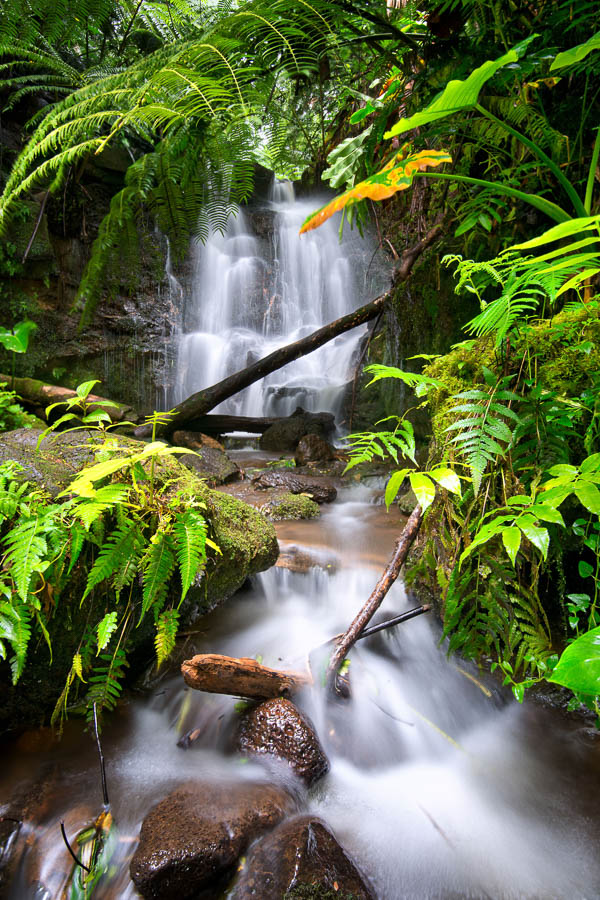
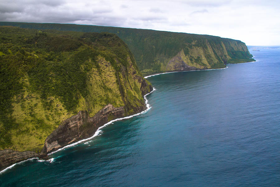
Hilo, the wettest city in Hawaii, shares a Climate Zone (Tropical Continuously Wet) with Singapore, West Palm Beach, Florida, and some of Hawaii’s best-loved and most-photographed locations: Waipio Valley, the Hamakua Coast, and Akaka Falls. These are the romantic tropical landscapes featured in travel guides and movies: the rushing, abundant fresh water, tropical forests and flowers, lush fields.
On the complete opposite side of the island, yet in the same Climate Zone, is the Kahuku Unit of Hawaii Volcanoes National Park, a 116,000-acre preserve of native forests, historic volcanic features, and relics of the ranching era. Park Rangers and volunteers offer regularly scheduled group hikes with different themes, to share the history and natural phenomena of this unique environment. They also host monthly Ike Hana Noeau cultural workshops, and informative Kau coffee talks. Programs are free. For more information, click here.
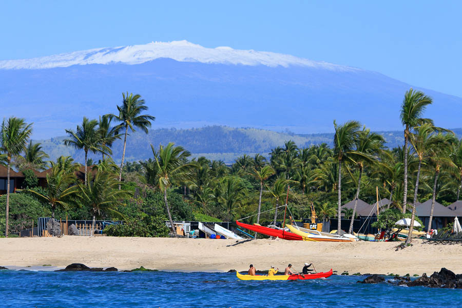
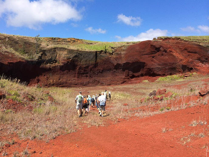
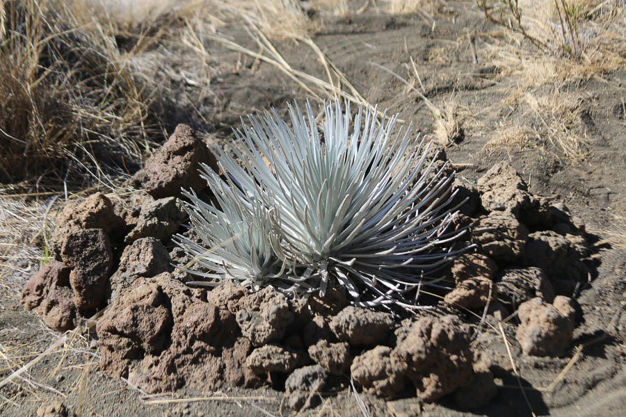
It’s ironic to think that some of the island of Hawaii’s most iconic resorts, with their world class golf courses and magnificent tropical grounds, are actually located in the desert. Like Death Valley, Phoenix, and Kuwait City, the entire west coast of Hawaii Island, without human help, would look very much like the black lavascape on the ma uka side of the Queen Kaahumanu Highway. These zones receive less than nine inches of rainfall per year. Hot and dry, it is not an easy place for plantlife or people yet there are interesting examples of everyday life up and down the coast.
Anaehoomalu (Waikoloa Beach Resort) has numerous anthropological sites, including traditional fishponds, anchialine ponds, where the endemic opaeula (red shrimp) thrive, and petroglyph fields. These unique markings carved into lava beds also include modern images with English alphabets and figures of ships and horses. Guided petroglyph tours are offered Tuesday-Sunday at 9:30a at the Kings’ Shops.
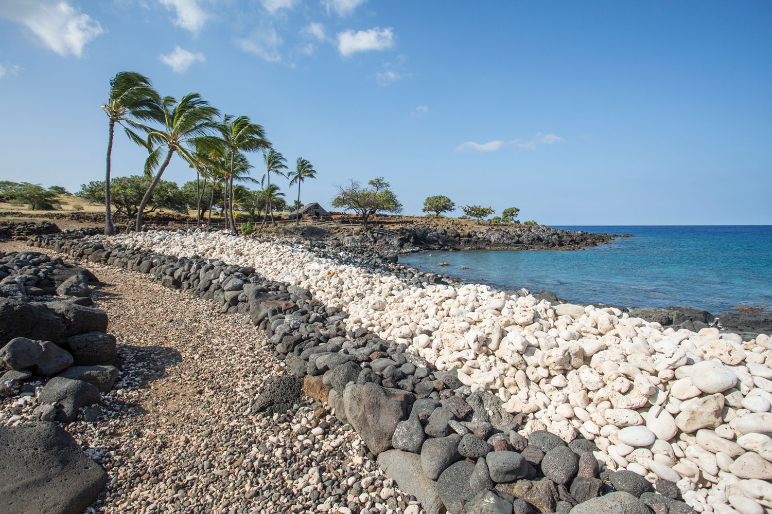
Just north of Anaehoomalu is Kalahuipuaa (Mauna Lani Resort). Near the southern boundary of this resort are several fishponds set among the natural coconut grove connected to the ocean by a series of makaha, wooden sluice gates, used to allow small fry to swim into the ponds, where they grew until large enough to eat. The Puako Petroglyph Preserve can be found at Holoholokai Beach Park at the northern boundary.
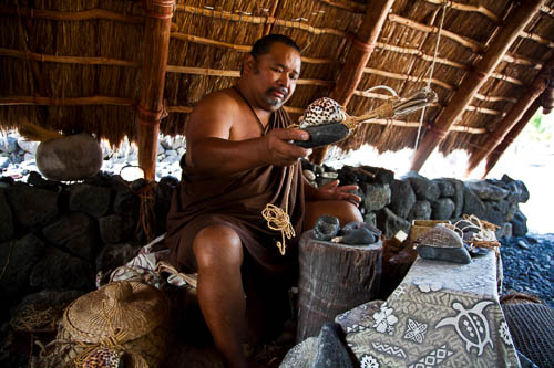
In places like Anaehoomalu, Kalahuipuaa and others, family villages survived and grew—fishing, making salt in rock “pans” along the shore, and trading with upland farmers. A few miles north, the partially-restored settlement of Lapakahi is another example.
Lapakahi State Historical Park is open daily from 8 a.m. to 4 p.m., closed on state holidays. Visitors can take a one-mile self-guided tour through rebuilt hale, houses, lava stone walls and more, to get a sense of what everyday life was like in the “desert.” Click here for more information.
Eia Hawaii, He Moku, He Kanaka Here is Hawaii, An Island, A Man

The island of Hawaii is celebrated proudly and affectionately as the space that sustained the indigenous people of this land for centuries. The space provided food in the ocean, rich volcanic soil to grow food and a dense forest to ensure fresh water cycles. Hawaii is an ancestor!
Since land is minimal in this vast, deep but warm ocean, the island of Hawaii is considered a gift. Few people of the world can boast of an island that continues to give birth to islands. Ola! (Live on!)
The island of Hawaii guarantees tropical climate at the seashore, however the mountain top is frigid and covered with snow during the winter. Hawaii is a world unto itself lacking nothing in weather preference. The fragrances, tastes and colors of the land are a tell-tale reminder of the bounty that emerges from Hawaii in the form of flowers, vegetation, fruits and people. We are Hawaii, the island, the man! Aloha!
Pualani Kanakaole Kanahele
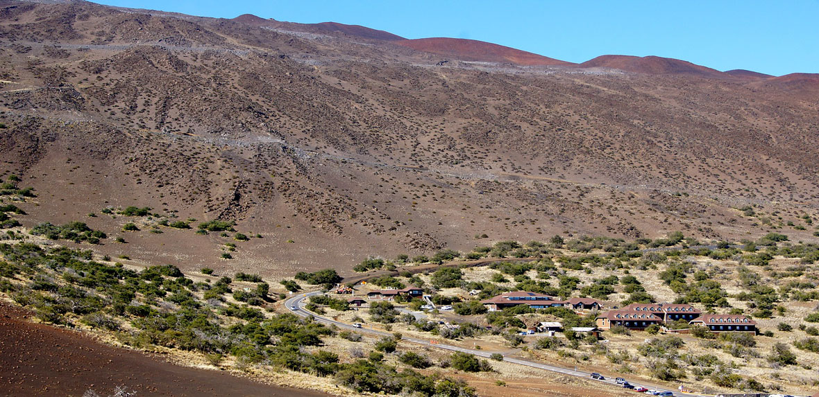
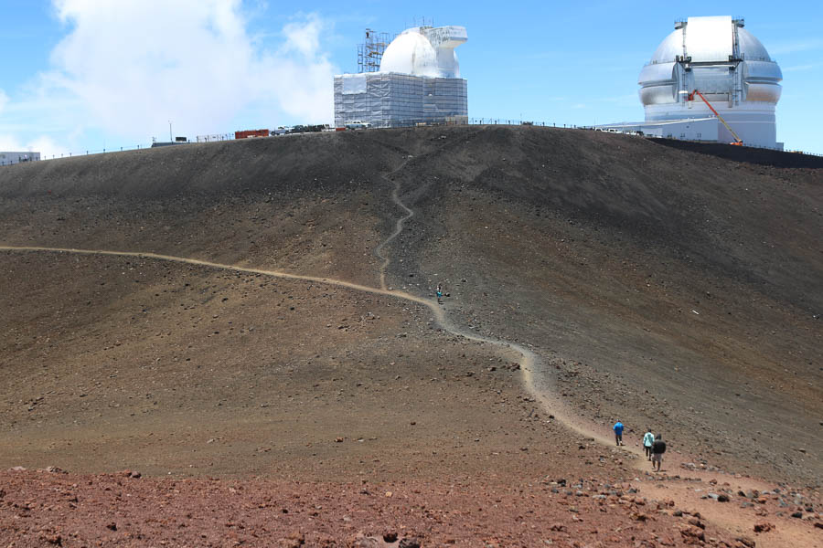
At the 9,200-foot elevation of Maunakea, is the Onizuka Center for International Astronomy Visitor Information Station (VIS). Located in the same Zone as San Francisco, Seattle, and Victoria, B.C. The VIS is a great way to learn about the international astronomy community and their work, as well as the living culture of the mountain.
The VIS offers almost everybody access to the stars. Open daily from noon until 10 p.m., the VIS is reachable by regular two-wheel drive cars. There are restrooms, interactive displays, and the First Light Bookstore with snacks, hot and cold beverages, and warm clothing, as well as books about astronomy and Hawaiian culture.
Stargazing events take place Tuesday, Wednesday, Friday and Saturday nights, 6-10 p.m., weather permitting. The evening begins with the PBS Hawaii documentary “First Light,” that describes the history and culture of Maunakea. Then, staff and volunteers share the night skies with telescopes set up on the VIS patio. On Saturdays, special programs take place, including an in-depth Hawaiian cultural perspective on the fourth Saturday of each month.
The VIS and Stargazing programs are free, although parking is limited to 115 cars on a first come, first served basis. Visitors are advised to be prepared for cold weather, bring a red-filtered flashlight, and check with rangers on weather conditions before going up. Click here or call 808-935-6268 for more information. http://www.ifa.hawaii.edu/info/vis/
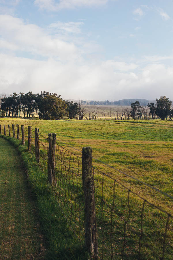
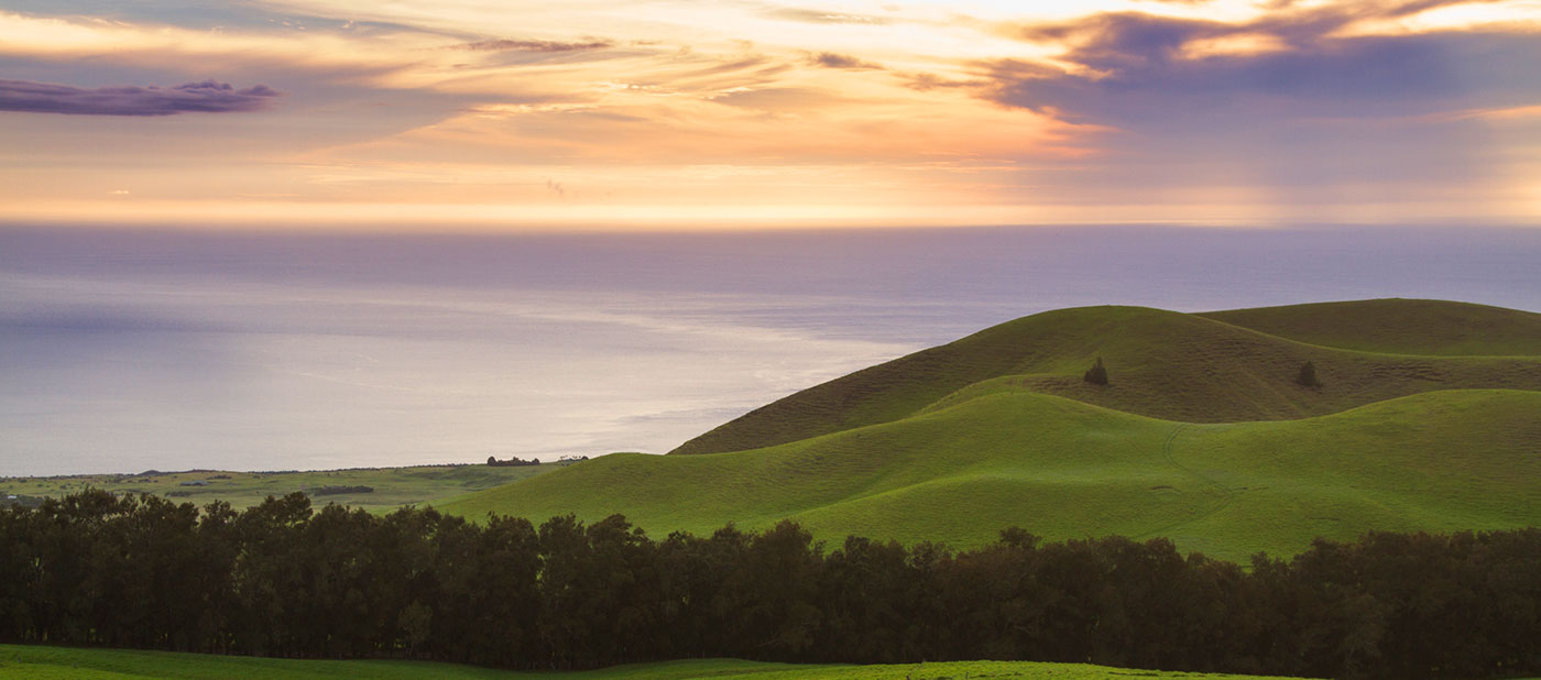
The Temperate Zone steps down and extends into greener and more productive lands, like the verdant, upcountry pastures of North Kohala, the tall forests of Hakalau and Kalopa and rolling hills of Waimea. It also includes the upper regions of Hawaii Volcanoes National Park. While at the Park, determined hikers can experience three different climate zones - Temperate Continuously Wet Warm near the Visitors Center, Humid Tropical Summer Dry along Chain of Craters Road, and Humid Tropical Continuously Wet in the Kahuku Unit.
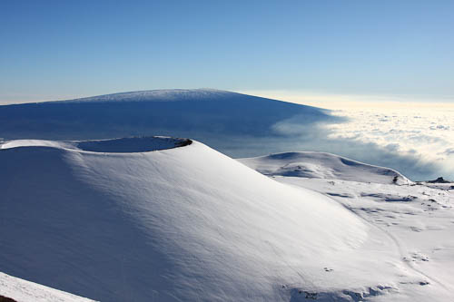
Not as cold as the frozen worlds of Antarctica or tundras of Greenland, the summits of Maunakea and Maunaloa are located in the Periglacial Zone, where even the warmest months average 50 degrees F or below.
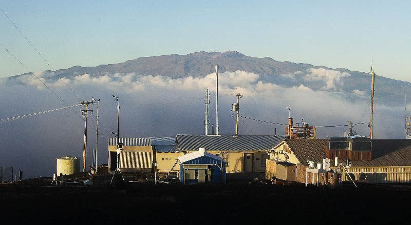
The Mauna Loa Observatory has resided on the mountain since 1956. Not a telescope or astronomical observatory, MLO collects atmospheric data and monitors changes, as part of the National Oceanic and Atmospheric Administration (NOAA) – Earth System Research Laboratory.
Among many other projects, it is the oldest continuous CO2 monitoring station in the world, and its most recent research shows continuation of a dramatic trend. In March, MLO announced CO2 in the atmosphere had increased by 3 parts per million (ppm) to 401.5 ppm. This matches the 2015 record increase and is, according to NOAA, “unprecedented in the observatory’s 59-year record.” For the curious, monthly averages can be tracked on the NOAA website.
Even a place steeped in so much serious science has a legend. MLO’s legend comes in the form of a little white dog, first noticed by the team in late 1959. The dog kept its distance from people, in spite of their efforts to feed or coax him closer. It is said that Pele, goddess of fire and volcano, would send a white dog as a warning when an eruption was coming, and in December 1959, Kilaueaiki erupted. Afterwards, the dog was gone, although he continued to appear and disappear until 1966.
Observatory tours can be scheduled about two weeks in advance, generally on Mondays and Wednesdays, by calling Aidan Colton at 808-933-6965. To see what’s happening at the Observatory any time, from any place, check out the live cameras on their website—including one from Maunaloa’s sister observatory at the South Pole.
The summit of Maunakea, the world’s tallest mountain, is also in the Periglacial Zone. Adventurers who can handle the altitude and cold winds step into two worlds: one, the high-tech astronomy community with its 13 international telescopes, another the ancient wahi pana, sacred place. The summit is best experienced on a permitted tour with seasoned guides.
Back in space, our island’s picture tells a somewhat different story. No longer a static image, we see Hawaii as a dynamic, living entity. A place where the works of wind and water, the rise and fall of land, the sun and the long dance of time create not just an island but a culture and people. Somewhere in these zones, between light and shadow, between science and storied legend, is the dimension of a universal imagination. It makes us who we are.